


Smart farming using drones
Smart farming is changing the old ways of taking care of your fields and cattle in the agricultural sector. Aerial data is the pushing force of this change.
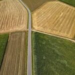
By inspecting their fields from above, farmers and agronomists can now gain situational awareness with unmatched detail. With the right tools, they get overviews of their fields, forests, or cattle and collect data much more efficiently than with traditional methods.
Gathering and analyzing data influences decision-making and improves yield. These processes are now as accurate and efficient as ever due to better software, sensors, and drones.
Soil & Field Analysis
Planting
Crop Spraying
Crop Monitoring
Irrigation
Health Assessment
Main applications of drones in smart farming
With the help of an unmanned aerial vehicle (UAV), any area can be represented in maps for pest and weed monitoring, vegetation mapping, irrigation, and soil erosion management. The drone-made maps help keep track of the health of your plants and animals and display changes or dangers before they get out of control.
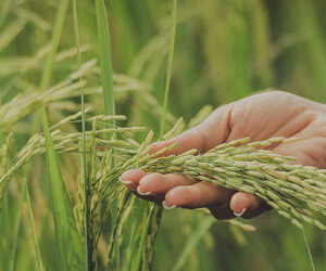
Yield estimation
Smart farming with accurate RGB sensors helps estimate yield more productively even before the harvest. For providing a visual representation of your land, standard RGB cameras look at three bands in the visible light spectrum: red (R), green (G), and blue (B). They produce images of a crop field or a forest similar to what we see with our eyes. Proper sensors, storing the largest amount of pixels, ensure the most detailed aerial pictures. With suitable photogrammetric software, they result in accurate yield estimation maps that help predict stock volume.
Crop health scouting
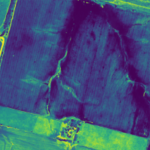
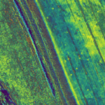
Drone crop inspection is one of the most efficient and effective ways to gain knowledge of crop health and pest activity throughout the cultivation process. With multispectral sensors you capture the light beyond the visible part of the light spectrum. This allows you to take action before problems even become visually noticeable and escalate. For example, too little nutrients in a plant result in insufficient photosynthesis, which can be seen in a small section of the red light band of your multispectral imagery.
Irrigation and soil management
Water and fertilizer wastage, under-irrigation, or machinery failures can damage plants. An agriculture drone assists you in spotting soil and irrigation problems before they critically harm the produce and wildlife. While detailed soil investigation still requires soil sampling, drones with multispectral and RGB remote sensing let you find the hot sports. Analyze mineral levels, dangerous topsoil degradation, and any typographical changes before they lead to irreversible damage.
Vegetation mapping
Images captured by a UAV can be transformed into a VI (Vegetation Index) map. VI is a combination of different light spectrum bands to highlight particular vegetation properties. Your custom VI map can be compared to, for example, the NDVI (Normalized Difference Vegetation Index) database, which holds the normal or healthy values of many crops. When the crop type is provided, image post-processing software contrasts the values of your map with the standard, automatically highlighting secretly problematic areas.
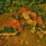
Forestry management
Drones can also facilitate the tasks of managing and caring for forests, woodlands, and wetlands. For forest managers, drones provide information on dense and otherwise inaccessible plots. When the forest grows, you can better understand the size, biodiversity, and tree and land conditions. A long-range UAV can give insight into the forest situation at any given time without putting anyone at risk, which is especially useful after natural disasters.
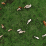
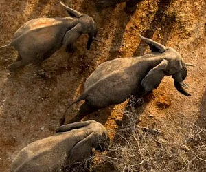
Cattle monitoring
UAVs are gaining increasingly more attention as a way to monitor and even herd cattle. One of the use cases of drone farming is the possibility for farmers to remotely check on their cattle, gaining flexibility in their daily operations. Remote monitoring can give insight into where the cattle are and whether they have access to water sources. The possibility to inspect land also comes in handy – you can monitor the state of the pasture and fences and see if there are any heavily grazed or dangerous spots from which the cattle should be directed.
BRAEBAN AERONAUTICS
Acquiring aerial data using drones
HOW WE DELIVER
Leverage the power of machine learning to understand population count, crop stress, and plant height, and make informed decisions that improve your crop yield.
Easily store and access historical data of multiple farms on a single platform for records.
LET US SHOW YOU HOW BRAEBAN CAN MAKE A DIFFERENCE
To find out how Braeban Aeronautics can assist with your specific requirements, contact us for a confidential discussion.
SEND US A MESSAGE
CONTACT INFORMATION
2807 N Parham Rd, Ste 320
Henrico, Virginia 23294
United States
Phone: 855-BRAEBAN
Direct: (855) 272-3226
Do you have questions about how Braeban can help your company? Send us an email and we’ll get in touch shortly.