


Deploy in seconds, arrive within minutes
Drones have revolutionized the way we respond to disasters.
In the past, responders had to rely on traditional methods of transportation and search and rescue missions. These methods were often time-consuming and costly, not to mention dangerous for the responders.
Drones, however, provide a much faster and more efficient way of responding to disasters. They can be used to quickly assess the situation, locate victims, and even deliver supplies and aid.
This article will explore the potential of drones in disaster response and the benefits they offer over traditional methods of relief and the potential solutions that are being explored.
Benefits of drones in emergency services
Emergency services across the country could benefit from using drone technology in a variety of ways:
Rapid deployment: Unlike helicopters, UAVs do not require runways or landing fields that can be launched quickly and easily from almost anywhere.
Access to remote areas: Emergency response drones can access remote and difficult-to-reach areas, enabling first responders to reach people and places that would be inaccessible by other means.
Improved situational awareness: With a bird’s eye view of the situation, drones provide first responders with a better understanding of the environment and help them make decisions faster.
Faster response time: Drones can quickly cover large geographic areas and provide real-time data to first responders, enabling them to make informed decisions and respond more effectively.
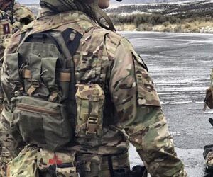
Increased safety: Drones minimize the risk to emergency responders by allowing remote operation from almost anywhere. In search and rescue, thermal sensor-equipped drones efficiently detect people in hard-to-reach areas like rubble and tunnels.
Cost savings: Drones help disaster response by quickly assessing damage, enabling accurate damage assessment, reducing costs, and speeding recovery. In addition, they reduce transportation costs by delivering medical supplies to remote areas.
How drones are used in emergency management?
First responder drones are now being used in a variety of ways to help people in emergencies. From providing critical information to delivering vital supplies, drones are proving to be an essential tool in emergency situations.
Providing real-time situational awareness
Drones can provide critical information in emergency situations. With applications to quickly survey a disaster site, drones can provide valuable insight into the local situation. Such information can help first responders make decisions about the best way to respond to the situation. Beyond that, drones are useful for identifying areas of concern, such as collapsed buildings, hazardous materials, or blocked roads. This data can then be used to help direct resources to the most severely affected areas.
Monitoring hazardous areas
Emergency drones can actually help prevent accidents and injuries. They are often used to monitor hazardous areas, such as construction sites or industrial sites, to detect potential safety risks and alert workers to take action. Drones can also be used to monitor and inspect infrastructure, such as bridges or pipelines, to detect any potential issues before they become a safety hazard.
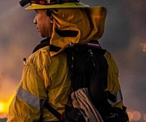
Search and rescue
Search and rescue operations are often dangerous and can involve access to hazardous environments that are difficult for humans to access. And rescue drone technology allows search teams to quickly and efficiently cover large areas and locate missing persons.
Equipped with a variety of sensors, such as thermal imaging cameras, rescue drones enable search teams to quickly detect heat signatures, as well as high-resolution cameras and audio pickups, which can provide valuable information about terrain and environmental conditions.
Delivering medical supplies
Emergency response drones can also be used to deliver vital supplies in emergency situations. Drones can quickly and safely transport medical supplies, food, and other essentials to areas that would otherwise be difficult to reach. This can be especially helpful in areas that are affected by natural disasters, such as floods or earthquakes. Drones can also be used to deliver medical equipment, such as defibrillators, to areas that may not have easy access to medical services.
Insurance assessment
Drones can survey damaged buildings, roads, bridges, and other structures, providing a comprehensive overview of the affected area. Images taken by drones can be used to calculate the cost of repairing or replacing damaged property so that insurance companies can quickly assess claims and provide compensation to policyholders.
Post-disaster reconstruction and recovery
Drones enable the possibility for quickly surveying and collecting data after a natural disaster. The 3D models and orthophoto maps collected by drones can be used to identify areas that have been damaged, assess the extent of the damage, and plan the reconstruction process. They can also be used to inspect critical infrastructure, such as bridges and power lines, to assess the extent of the damage and determine if they are safe for use.
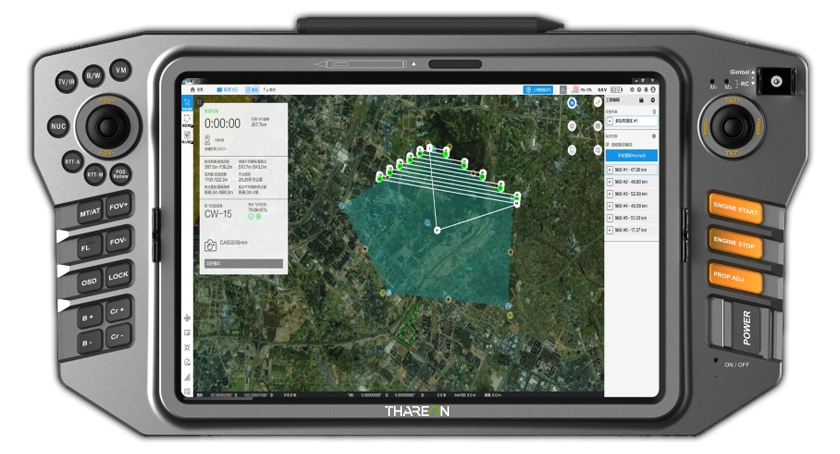
Thareon Drone Mapping Software
Main applications of drones for good
Drone applications are expanding each day – not only due to rapid technical developments but also constantly emerging creative approaches to pressing problems. How to utilize a UAV is an open question – currently, the most popular ways in the sector revolve around monitoring flora and fauna and providing support in high-risk areas.
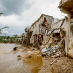
Environmental disaster response
After natural disasters like floods or hurricanes, UAVs can be rapidly deployed to bolster response efforts. They provide real-time information for rescue and reaction teams about the situation on the ground without putting emergency workers at risk. For example, during forest fires, drones with infrared cameras help spot hotspots and increase situational awareness for firefighters.
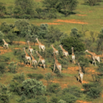
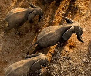
Wild animal conservation
Drones offer a non-intrusive means to monitor animal populations and observe their behavior. This is handy in various conservation efforts, as (potentially dangerous) animals can be easily tracked and counted, and their migration patterns examined. While the focus might be the wildlife, the same UAV is useful in detecting illegal poaching activities, too.
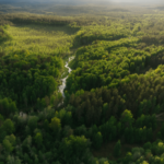
Forest monitoring
Using different camera systems, drones can holistically monitor forests, woodlands, and wetlands. Using multispectral imagery, UAVs allow you to observe plant species and their overall health – irrigation levels, diseases, and biodiversity. At the same time, regular high-resolution imagery capture can help detect illegal deforestation and track both deforestation and reforestation efforts.
Humanitarian aid delivery
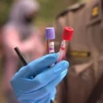
Delivering medical goods to areas in need is one of the most widely recognized drone uses. Due to their long-range capabilities, VTOL UAVs can access remote areas where supplies are lacking and deliver medical or nutritional aid autonomously. In such places, UAVs also stand out in efficiently transporting blood or other samples for analysis.
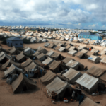
Sensitive area management
VTOL UAVs are crucial in managing sensitive zones like refugee camps, where their ability to capture detailed imagery supports the strategic planning of shelter locations, essential infrastructure, and access to resources. These UAVs also play a key role in designing escape routes by analyzing terrain and environmental conditions to enhance safety and emergency responsiveness, thereby safeguarding the welfare of displaced communities.

Water quality and coastal research
Drones can gather high-resolution data through advanced sensors that track water contamination, temperature variations, and ecosystem health. This data is valuable in both enforcing conservation efforts and facilitating the sustainable management of aquatic resources. Aerial footage also enables non-invasive monitoring of sea mammals, which is crucial for understanding their behaviors and population health.
Elevate your operations with Braeban
A fixed-wing VTOL UAV is easy to employ and operate and is an accessible tool for virtually anyone who is ready to explore drone security. A drone can be conveniently transported, quickly collected and ready for an operation in a few minutes. Unlike traditional aircraft, they do not require a runway for take-off or landing, allowing them to be deployed in a variety of environments.
Some drones are even capable of performing missions fully autonomously, eliminating the need for constant human control. This makes any surveillance
and mapping task go smoothly from the beginning to the point of packing the drone back up.
With the rapid acceleration of technology in recent years, the gap between commercial and military drones is closing rapidly. Today, VTOL (Vertical Take-Off and Landing) UAVs offer a serious alternative to traditional military drones, with longer flight times, improved sensors, and military-grade capabilities.
Braeban vtol Drone

Enhanced Autonomy
Perform complex ISR missions with minimal human intervention for flight ranges up to 270 km (168 mi)

Data Breach Monitoring
Proactively monitor your personal email address & receive notifications if your data is compromised.

Advanced Aerodynamic
Our patented wingshape ensures efficient flight performance. For flight times up to 4.5 hours

State-of-the-art Material
Produced in Europe with the highest quality materials and composites
Let us show you how BRAEBAN CAN MAKE A DIFFERENCE
To find out how Braeban Aeronautics can assist with your specific requirements, contact us for a confidential discussion.
SEND US A MESSAGE
CONTACT INFORMATION
2807 N Parham Rd, Ste 320
Henrico, Virginia 23294
United States
Phone: 855-BRAEBAN
Direct: (855) 272-3226
Do you have questions about how Braeban can help your company? Send us an email and we’ll get in touch shortly.